
The project

About Japan Trains Live

Japan Trains Live is two things at once: a map of trains moving across Japan's rail network in real time, and an encyclopedia of the lines, trains, operators, and rolling stock behind them. This page explains how both are built — and why a given train is, or isn't, on the map right now.

Line 01 · The map

Why trains appear and disappear

The moving dots aren't a GPS feed. Every train is placed by following its published timetable: we work out where each train should be right now — which two stations it's between, at the current time in Japan — and show it on the track between them.

A train appears only while it is scheduled to be running. It joins the map when its departure time arrives and leaves once it completes its final stop. Because the clock runs in real Japan time, the active-train count rises and falls through the day — busiest at the morning and evening peaks, nearly empty overnight.

A line shows track but no trains when we don't yet have a timetable or a frequency estimate for it; coverage grows as more operators' schedules are added. You can also hide whole categories — Shinkansen, metro, regional, local — from the Trains panel, in which case those trains simply aren't drawn.

Line 02 · Confidence

Scheduled vs Estimated

Every train carries a small badge showing where its schedule comes from:

Scheduled

the train follows an official published timetable (a railway operator's own website or timetable, or an operator-published open-data feed).

Estimated

we don't have a timetable for that service, so its pattern is estimated from typical service frequency (currently derived from OpenStreetMap). The dot still follows the real track, but the timing is approximate.

TRACK 16N700S · SCHEDULED
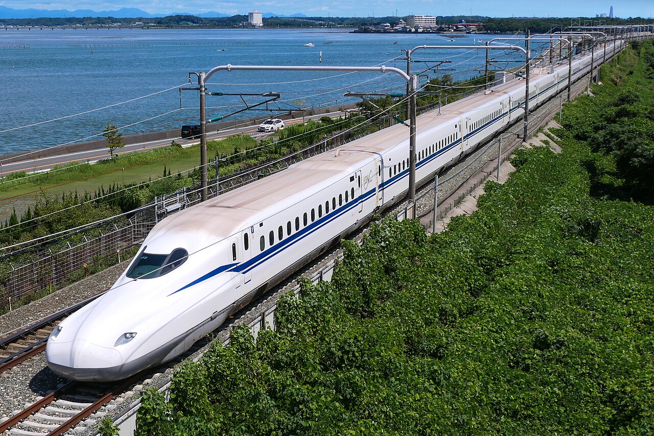
N700S on the Tōkaidō Shinkansen N700S · Tōkaidō Shinkansen
N700S · Tōkaidō Shinkansen

Shinkansen and other timetabled services — like this N700S on the Tōkaidō Shinkansen — run to a published schedule.

Scheduled
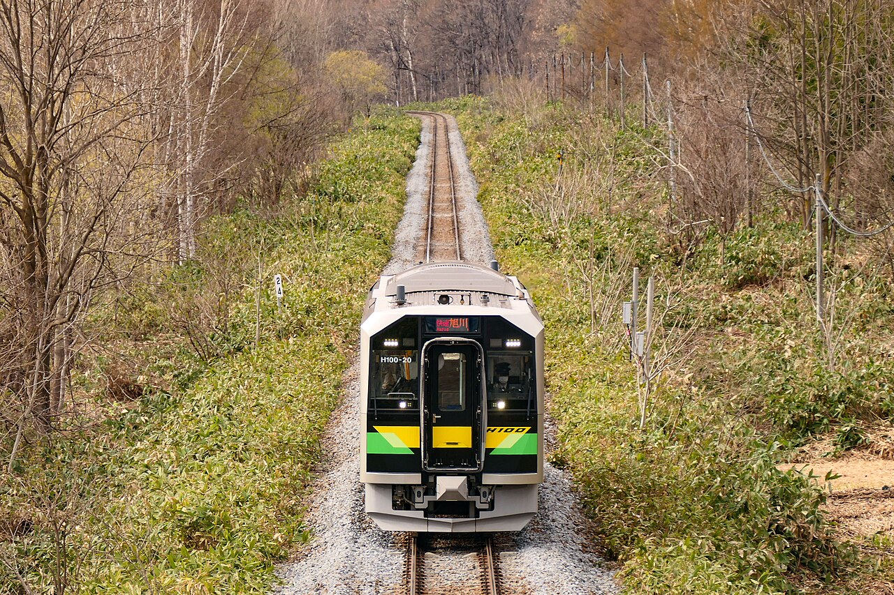
TRACK 1LOCAL · ESTIMATED
H100 local on the Sōya Main Line Sōya Main Line · local
Sōya Main Line — local

Rural and local services we don't have a timetable for — like this Sōya Main Line local — are estimated from typical frequency.

Estimated

Open any train's card to see the specific source named in full.

Line 03 · Provenance

Where the data comes from

  • Train schedules — official timetables published by the railway operators themselves: the JR companies, the major private railways, and municipal subways, plus operator-published open-data feeds where available. Where we don't have a timetable, a frequency estimate is used and clearly marked Estimated.

  • The rail network — every line's shape and every station's location come from Japan's Ministry of Land, Infrastructure, Transport and Tourism (国土交通省) National Land Numerical Information, and from OpenStreetMap (CC BY-SA).

  • The base map and terrain — Google Maps, with terrain imagery credited to NASA.

  • The articles — line histories and rolling-stock, operator, and named-service profiles are written from the English and Japanese Wikipedia and Wikidata, and each article lists its sources.

  • The photographs — from Wikimedia Commons. Every image is freely licensed — public domain or Creative Commons — and credited on the page to its photographer and licence.

Line 04 · Integrity

How we keep it accurate

We follow one simple rule — cite-or-skip: if a fact can't be traced to a source, we leave it out rather than guess. Every photo is checked to make sure it really shows what it says — and that it's free to use — before it goes up. And anything we've estimated, rather than taken from a real schedule, is labelled as such.

For the encyclopedia articles, we read both the English and Japanese Wikipedia pages on each subject and combine what they cover. The two versions often differ — and for Japanese railways the Japanese page is frequently the more detailed of the two — so drawing on both gives a fuller, more accurate account than either alone.

Line 05 · Contact

Questions or feedback?

Have feedback, a correction, or a question? The Contact page has a quick form and our email.

Get in touch
← Back to the live map